Rieker Total Solutions

Advanced Solutions for Roadway Safety and Pedestrian Accessibility

Rieker Total Solutions is a suite of advanced hardware + software systems designed to solve two of the most critical challenges in modern infrastructure:

  • Determining safe horizontal curve advisory speeds and roadway signage CARS
  • Ensuring ADA compliance of sidewalks and curb ramps in the public right-of-way ADAM

Built on Rieker’s trusted sensor technology and enhanced with mobile tools, computer vision, and photogrammetry, these solutions empower transportation agencies, municipalities, and engineering firms to deliver faster, safer, more defensible outcomes. Our commitment to advanced solutions for roadway safety and pedestrian accessibility ensures communities can address both drivability and accessibility challenges with confidence.


Learn more about CARS - Curve Advisory Reporting Service Learn more about ADAM - ADA Sidewalk and Curb Ramp Compliance Solution Register for a webinar to learn more about one or both of these Total Solutions
Learn more about CARS Request a Webinar

CARS – Curve Advisory Reporting System

Horizontal Curve Safety & Signage Compliance

Need to evaluate roadway curves for safe speed recommendations and MUTCD-compliant signage?

CARS simplifies horizontal curve analysis by using Rieker’s high-accuracy sensors and intuitive software to automatically calculate advisory speeds and recommend signage and placement — all based on field data captured in a single drive-through. The result: faster evaluations, reduced labor, and consistent compliance with FHWA guidelines and Zero Deaths initiatives.

Rapid, single drive-through curve assessments
MUTCD-compliant signage recommendations
Used by DOTs, transportation engineers, and safety consultants

Learn more about ADAM Request a Webinar

ADAM – Advanced Data Acquisition & Measurement

A Total ADA Compliance Solution for Public Right-of-Way Infrastructure

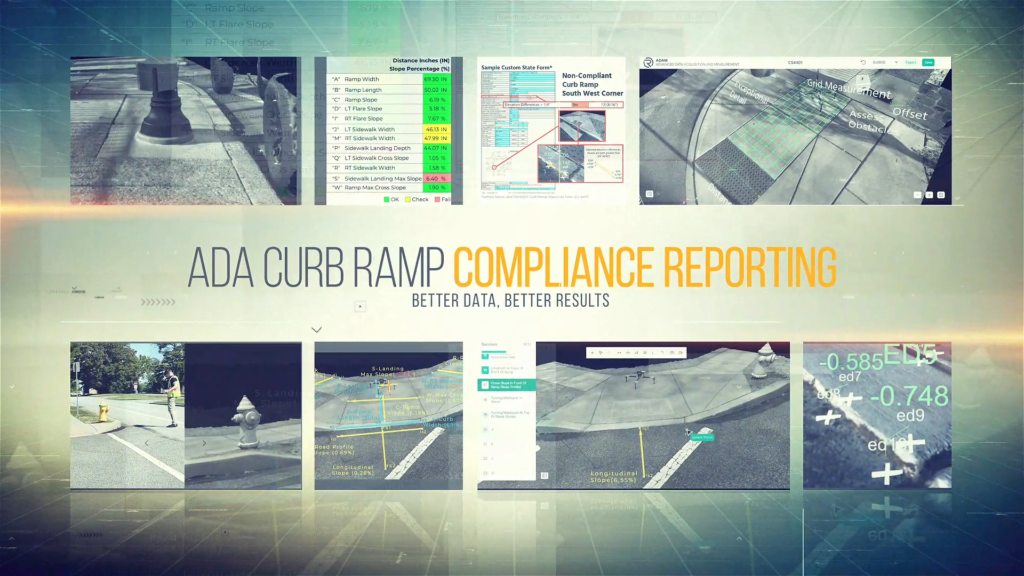
ADAM is Rieker’s fully integrated solution for evaluating the accessibility of sidewalks, curb ramps, and other pedestrian infrastructure in the public right-of-way. It combines mobile field tools, precision sensor data, structured workflows, and web-based reporting to support everything from high-level assessments to full engineering and remediation planning.

With ADAM, teams can capture slope, dimensions, and geolocation data in minutes, generate consistent compliance records, and share detailed models with engineers — often without returning to the field. The system also features job coordination and oversight tools to support larger deployments, ensuring projects stay on track and deliver defensible, NIST-traceable results.

Whether you’re performing spot-checks, managing a citywide inventory, or planning ADA upgrades, ADAM provides a scalable, cost-effective path to accessible infrastructure

Assessment – Capture accurate slope, distance, and spatial data in minutes using a guided or flexible mobile workflow — minimizing time in the field while maximizing consistency and confidence.

Compliance – Automatically generate structured, defensible reports with GPS-tagged photos and standardized outputs — helping agencies meet ADA documentation requirements with ease and reliability.

Engineering – Produce detailed 3D infrastructure models from collected imagery and sensor data — enabling effective design and remediation planning without requiring additional site visits.

Job Management – Coordinate, assign, and track inspections across teams and locations — ensuring timely project completion and organized oversight of compliance activities at any scale.

Rieker total solutions Webinar registration

Please fill out the form below to register for our Total Solutions Webinar

"*" indicates required fields

Name*
Solutions You Are Interested In*
This field is hidden when viewing the form
Presentation type
Presentation type is determined from the referring link.
This field is for validation purposes and should be left unchanged.